Skip to content
Skip to navigation
Site map
An official website of the Marin County Department of Public Works
Action toolbar
Translate
Translate language select
Search
Marin County Flood Control District
Primary menu links
Watersheds
Flood protection
Projects
Meetings
News
About
Marin County Flood Control District
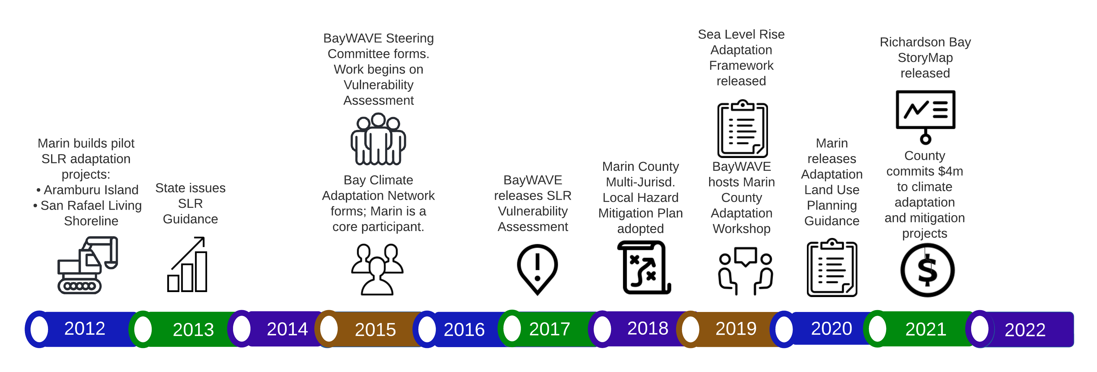
BayWAVE Timeline Whitebackground 300ppi
Helpful
Share
Facebook
Twitter
Email
Size
+
Reset
a
−
This content is for decoration only
skip decoration
.
Close window
Search Site
Search
Close window