The Marin County Flood Control and Water Conservation District is working with Caltrans to develop flood reduction strategies for the Manzanita area. These strategies include short, medium and long term flood mitigation solutions to the persistent flooding issues at the Manzanita parking area and Shoreline highway.
What’s the problem?
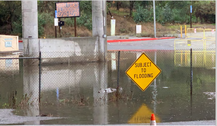
Tides can flood Manzanita at the Highway 101 and Highway 1 interchange. This can lead to lane and road closures, including access to the Highway and flooding of the Caltrans park & ride lot. It can also affect transit routes serving the area.
Why does it occur?
Much of the Richardson Bay shoreline was developed at a relatively low elevation on top of soft, bay mud. This has subsided over time. The elevation of roads, parking lots and some buildings are now lower than some higher tides. This makes the area susceptible to flooding.
When does it occur?
Tidal flooding can encroach on roadways and parking areas starting at an elevation of around 6.2 feet as measured in the mean lower low water (MLLW) datum at the San Francisco (Golden Gate) gage.
High tides are affected by several factors. They can occur at any time of the year and may be especially high during certain astronomical cycles. Tides which occur during these cycles are often referred to as King Tides.
Also, observed tides may be higher than predicted due to high winds, warmer than normal sea surface temperatures, and atmospheric pressure, among other factors. Sea-level rise will also play an increasingly large role in coming years.
What can be done to fix the problem?
While there is no quick or easy fix, Caltrans and Marin County Flood Control & Water Conservation District are working together on various potential short and long-term options to alleviate the problem.
The District has implemented a temporary, 175-foot long sandbag wall to help limit the direct tidal flooding of the roadway. During Spring 2017, Caltrans plans to install a one-way valve on the drainage pipe along Shoreline Highway and two screw gates on the culverts east of Highway
101.
These projects will help reduce non-storm related flooding issues, such as those from high tides. While long-term improvements are being actively assessed, it is clear that any solution will be very complex, costly and require years to complete.
What can be done now?
We must all learn to be aware of and have a plan to respond to tidal conditions and flooding in order to reduce the impacts it may have on our lives. This may include using alternative routes and/or allowing extra time for your trip – especially during peak times of commuter and holiday travel.
Travelers should be aware that Caltrans routinely closes the Manzanita park & ride lot when tides and weather are expected to threaten the safety of motorists. Caltrans notifies the public in advance via changeable message signs in the area, as well as posting on their website and Twitter.
Also, the Marin County Watershed Program hosts meetings for Richardson Bay (part of Flood Control Zone 3). The public is encouraged to attend and become involved.
Resources to help you plan ahead
- Checking tide predictions and observed water levels at the San Francisco (Golden Gate) gage
- Monitoring current traffic conditions and transit information at 511.org
- Following Caltrans on Twitter for information on possible road and parking lot closures or visiting the District 4 website
- Following Marin County Department of Public Works on Twitter and on
Facebook - Signing up for public safety alerts at Nixle