Marin County Department of Public Works coordinates with all of East Marin's cities and towns to provide an ongoing public process that helps local communities understand and prepare for sea level rise.
This multi-jurisdictional coordination is critical, as sea level rise crosses political boundaries to impact our shared resources, utilities, and infrastructure.
Marin County works with local communities to:
- Develop project ideas
- Integrate public input
- Support local project efforts
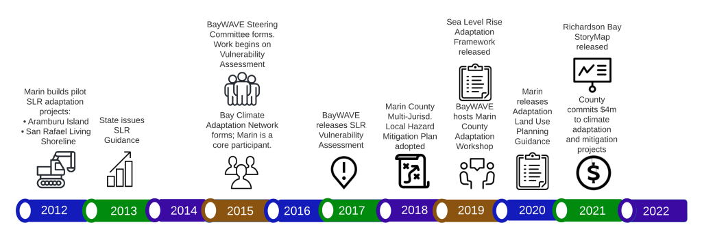
In 2017, Marin County Department of Public Works completed the Marin Shoreline Sea Level Rise Vulnerability Assessment, a technical report detailing how shoreline flooding will worsen with sea level rise if no actions are taken.
Learn about the Marin Shoreline Sea Level Rise Vulnerability Assessment