Marin County sea level rise projects map
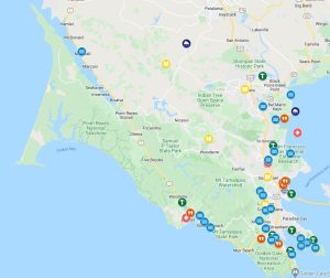 From community engagement programs to conceptual designs and "shovel ready" projects, sea level rise adaptation efforts are underway in many parts of Marin.
Richardson Bay Resilience Storymap
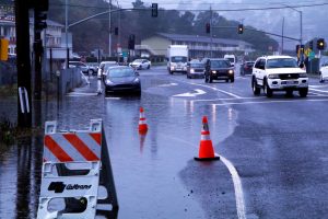 Residents and visitors to Richardson Bay know all too well about the ongoing flooding issues affecting this area of Marin's shoreline, where large rain events and high tide conditions cause disruptive flooding multiple times a year.
With a SB1 grant from CalTrans, Marin County Department of Public Works produced an interactive storymap that explores the issue, shares completed studies, and identifies future risks and possible solutions.
Scroll through the Richardson Bay Resilience Story Map to:
- Explore flooding impacts (to transportation, access emergency services, and access to parks, trails, and open space areas)
- Learn about possible solutions
- Share your ideas
Adaptation Land Use Planning Guidance
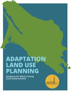 The Adaptation Land Use Planning Guidance provides sea level rise specific planning guidance and recommendations for the towns and cities in Marin County and unincorporated Marin. It was produced by Marin County planners in dialogue with our local jurisdictions.
The report assesses numerous adaptation tools including:
- Planning programs
- Regulatory tools
- Tax and market-based tools
- Floodplain management tools
It also describes a sample planning scenario in Tamalpais Valley to illustrate the process for connecting capital improvement and policy adaptation decisions.
Sea Level Rise Adaptation Framework
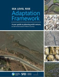 Developed by Point Blue Conservation Science and the San Francisco Estuary Institute in partnership with County of Marin, the Sea Level Rise Adaptation Framework is intended to help planners and others include nature-based strategies in addressing sea level rise hazards.
Specifically, it explains how to identify suitable nature-based measures for specific site conditions and how to evaluate which combination of measures may help achieve desired outcomes. Nature-based strategies for addressing sea level rise include measures like:
- Restoring coarse beaches to reduce wave energy
- Conserving and restoring wetlands to act as storm surge buffers
- Preparing "migration spaces" marshes can move into as sea levels rise
This guide was made possible with funding support from the Buck Family Fund of the Marin Community Foundation and California State Coastal Conservancy.
Sea level rise scenarios
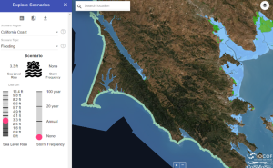 Sea level rise is a shared issue—floodwaters do not stop at jurisdictional boundaries.
To ensure coordination and consistency across local jurisdictions’ planning efforts we recommend local vulnerability assessments and adaptation plans use the same sea level rise scenarios used in the County’s Marin Shoreline Sea level Rise Vulnerability Assessment process.
The sea level rise scenarios are based on best available science and are consistent with current adaptation guidance from State of California.